Tropical disturbances often brew during the summer months in the North Atlantic. Many fizzle and fade with no consequence, yet a select few grow in strength and bring about devastating results when they make landfall as hurricanes. One of the great remaining mysteries of the tropical atmosphere is determining what conditions lead to the birth, or cyclogenesis, of these potentially life-threatening weather systems. One Naval Postgraduate School professor and his close colleagues believe they have uncovered a critical piece of the complex jigsaw puzzle of tropical cyclogenesis, and recently took to the storm-entrenched Northern Atlantic Ocean to test their overarching hypothesis.
"We've uncovered a key ingredient in the birth of hurricanes," said Dr. Michael Montgomery, a professor of meteorology at NPS, and principal investigator and lead scientist of the Pre-Depression Investigation of Cloud-systems in the Tropics (PREDICT) research project conducted Aug. 15 to Sep. 30.
Supported by funding from the National Science Foundation, PREDICT researchers based an operations center on St. Croix in the U.S. Virgin Islands during the height of hurricane season in hopes of collecting information that would identify precursors to which storms would bring danger and which ones would dissipate over the ocean. Taking to the Atlantic to study hurricanes proved fruitful for PREDICT investigators and atmospheric conditions were ideal for storm observation.
“We were very fortunate for the weather we encountered,” noted Montgomery. “Before the experiment started, I thought if we were able to study two developing and two non-developing disturbances then our collection efforts would be considered successful. During PREDICT we were able to study four developing and four non-developing storms! Potentially, we hit pay dirt during this experiment.”
At the core of PREDICT research was an investigation of tropical waves and sub-tropical disturbances and their role in producing a dynamically favored “sweet spots”. These so-called pockets of air are thought to protect growing storms from conditions that could lead to their demise. This protection zone from hostile storm killers plays a critical role in the spawning of disastrous tropical disturbances, since only about 20 percent of all Atlantic disturbances actually grow into these devastating storms.
“The overarching hypothesis is that the tropical waves that come off the African continent or are spawned in the Atlantic somewhere provide some protection in a particular region of the wave called the moist critical layer,” said Montgomery. “This area within the trough axis of the wave may provide a focal point and region of protection to be able to sustain thunderstorm activity and allow these thunderstorms to congeal. In a nutshell, that’s the basic idea.”
This concept, known as the “marsupial paradigm”, was brought forth in a 2009 study published by Montgomery and research colleagues Dr. Zhuo Wang and Dr. Timothy Dunkerton. It hypothesized that storm clusters moving at a similar speed to surrounding air flow in the lower troposphere are largely protected from being torn apart. This protective environment is a likened to a marsupial’s pouch during gestation, and is thought to be a key ingredient in the birth of hurricanes.
“We call it a marsupial pouch, because it's like a mother kangaroo's pouch that provides a nurturing environment for the storm and gets it to the point where it gains enough strength to jump out of the pouch," noted Montgomery.
The study and understanding of cyclogenesis can help forecasters and scientist better track and forecast these precursory conditions held within these pouches. These clues to hurricane formation can lead to earlier notification and storm tracking times. Ultimately, these deterministic genesis predictions can save lives.

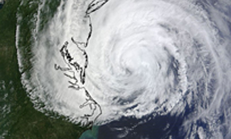
A MODIS image captured from NASA's Terra satellite on Friday, September 3, 2010 at 12:04 p.m. EDT of Hurricane Earl off the Mid-Atlantic. Hurricane Earl developed into a category four storm and was one of four named storms studied during PREDICT research.
This concept, known as the “marsupial paradigm”, was brought forth in a 2009 study published by Montgomery and research colleagues Dr. Zhuo Wang and Dr. Timothy Dunkerton. It hypothesized that storm clusters moving at a similar speed to surrounding air flow in the lower troposphere are largely protected from being torn apart. This protective environment is a likened to a marsupial’s pouch during gestation, and is thought to be a key ingredient in the birth of hurricanes.
“We call it a marsupial pouch, because it's like a mother kangaroo's pouch that provides a nurturing environment for the storm and gets it to the point where it gains enough strength to jump out of the pouch," noted Montgomery.
The study and understanding of cyclogenesis can help forecasters and scientist better track and forecast these precursory conditions held within these pouches. These clues to hurricane formation can lead to earlier notification and storm tracking times. Ultimately, these deterministic genesis predictions can save lives.
“One of the big questions we’re trying to answer is why only a small portion of the many tropical disturbances turn into tropical depressions,” said Michael Bell, a PREDICT scientist and research assistant professor at NPS.
Currently many storms develop too quickly for adequate preparations to be made in populated areas that sit in a brewing storm’s path. A better forecast into the development of these storms would lead to better warning times for emergency management officials and short-term mitigation efforts.
“Earlier prediction means earlier warning. An earlier warning gives people and customers more time to prepare and get out of the way,” said Montgomery.
Montgomery noted also the implications of his research on military operations.
“Better tracking and forecasting the precursors to storms gives more lead time and awareness. It’s this situational awareness that is invaluable to military leaders while operating in theatre,” he said. “This work is Navy relevant because it’s studying severe weather in the tropics, and that is a particular issue that makes the fleet very vulnerable during military operations. Fleet commanders don’t want to get hit by a surprise typhoon that costs equipment, time and lives.”
Previous research efforts made progress in the prediction of the formation of tropical depressions, storms and tropical cyclones, but were limited in scope of sampling. To address these limitations, Montgomery and his scientific colleagues worked to dramatically increase the spatial and temporal sampling of tropical disturbances prior to and during their formation. To achieve these objectives, scientists involved in PREDICT utilized the NSF/NCAR Gulfstream V research aircraft.
“We flew 26 flights into eight disturbances. Four of these disturbances, Fiona, Carl, Matthew and Nicole developed into named tropical storms or hurricanes. Four other disturbances did not form storms,” Montgomery added.
Also known as HIAPER (High-performance Instrumented Airborne Platform for Environmental Research), the specially modified research jet has a range of up to 7,000 miles and operates at an altitude of 43,000 feet. This aircraft provided researchers with the unique capability of sampling candidate tropical disturbances over a deep layer (> 10 km) of the atmosphere and permitted sampling of their structure on multiple spatial scales. These heights allowed researchers to take samples and data collections form near the top of these disturbances in order to obtain a more complete look at the dynamics and thermodynamics of tropical depression formation.
An integral tool in the airborne collection efforts was the use of global positioning system (GPS) dropsondes. 500 of these parachute-borne instrument packages were dropped in the path of tropical systems and were used to collect data such as wind speed and direction, pressure, temperature, and relative humidity.
Researchers also outfitted the NSF/NCAR G-V aircraft with double crews to extend flight hours and sampling periods. Two flight crews meant that scientists taking part in PREDICT could measure storm systems and their precursor environs for up to 16 hours per day in a 24 hour period. Collaboration with National Oceanic and Atmospheric Administration (NOAA) WP-3D aircraft also aided in PREDICT’s data collection efforts. NOAA’s aircraft was able to assist in testing and recording of atmospheric conditions with a tail-mounted Doppler radar, and a lower-fuselage weather surveillance radar.

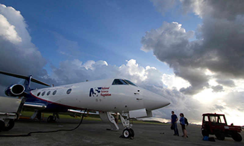
The NSF/NCAR Gulfstream V research aircraft prepares for a data collection flight on St. Croix in the U.S. Virgin Islands.
“With the Gulfstream V we were able to fly many consecutive days and collect data on several systems,” said Montgomery. “We didn’t just go out and sample one system and not go back. In one case, we were able to fly one system twice in one day.”
The effectiveness of collection tools and equipment afforded researchers the ability to record storm data, and the ability to properly position research aircraft was attributed to superb forecasting by the PREDICT research team.
“We developed some new tools for the forecaster,” said Montgomery. “With these forecast products we could identify where the center of those pouches were, and were able to target and construct flight patterns accordingly. We wanted to pinpoint that spot and put our aircraft in the neighborhood. Again and again and again we were able to place our aircraft right where it needed to be to collect data.”
Exceptional research methods and tools, coupled with near-perfect meteorological conditions in the area surveyed, proved to have monumental impacts on the collection of important data regarding storm formation, prediction and modeling.
The more research and data collected on naturally occurring storms, the more scientists stand to improve current forecasting models.
“This experiment is poised to help shed some light on the ability of our current models to distinguish between forming and non-forming disturbances,” said Montgomery. “Collecting this amount of data has ramifications on our ability to predict these storms as well as integrate our current model’s ability to forecast storms.”
Researchers from PREDICT also worked in tandem with two other studies focusing on hurricanes in the Atlantic this year; NASA’s Genesis and Rapid Intensification Processes (GRIP) and NOAA’s Intensity Forecasting Experiment. Other collaborators taking part in PREDICT research efforts include the University at Albany-State University of New York, the University of Illinois at Urbana-Champaign, the University of Miami, NorthWest Research Associates, Redmond, Wash, New Mexico Tech, Purdue University, and the University of Wisconsin-Madison. Preliminary finds of PREDICT research are currently being written up by Professor Montgomery and the PREDICT team for the Bulletin of the American Meteorological Society, a monthly journal that reports some of the latest developments in Atmospheric Science.

